Media Location Tagger started life as a feature request for A Better Finder Attributes.
A Better Finder Attributes has been able to write GPS coordinates into photos for years, and it does so the way it does everything else: you type a latitude and a longitude into two text fields, and it stamps those values onto every file in the batch. That works, as far as it goes. In 2023 I sat down to make it a little nicer. Better formatting, perhaps a small map, parsing for the many ways people write coordinates.
It did not take long to realise that I was polishing the wrong thing.
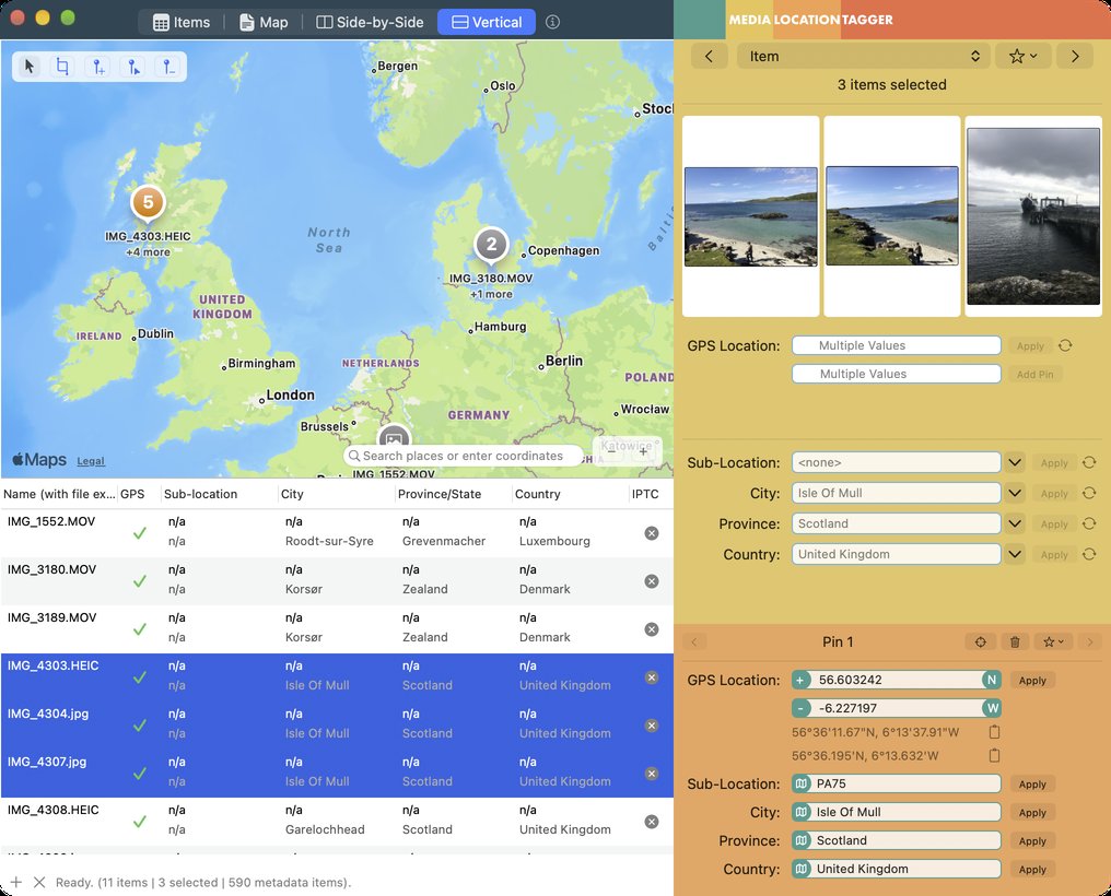
Setting a location is not a batch job. Nobody has 300 photos that all belong at exactly the same spot. A trip produces a trickle of places, and the files come back in three states. Some have coordinates already, from a phone, and only need the city and country names filled in. Some have the wrong location. Some, typically from a proper camera, have nothing at all. You need to see where the files are, pick out the ones that belong together and put them in the right place. That is a map problem, and it wants a map interface: multiple selection, tools that work on the map itself, and an easy way to take the location from one file that has it and give it to a dozen that do not.
So rather than bolt a map onto A Better Finder Attributes, I started a separate application built around one. The first experiments date from November 2023, and within three weeks the prototype was reading GPS tags and showing them as markers on a map. Everything since has grown out of that one decision: the map is the primary view and the file list serves it, not the other way round.
Three years, in bursts
Development happened in the gaps between releases of the other apps, eight bursts of a few weeks each spread over almost three years. The core app came together in the summer of 2024, pinning a location to files that autumn, and the big push was the winter of 2025, when the multi-pin map, clustering and the metadata write engine were built. A public beta went out on 10 September 2026, and six weekly betas later, shaped by the bug reports of the people who tried it, here is 1.0.
What it does
Drop photos and videos onto the window and they appear on the map. Files without coordinates are flagged. Drop a pin where they were taken, select them, apply. Files that already have coordinates get their IPTC city, province, country and sub-location names from Apple Maps or from a built-in offline database, and you can type your own names where you disagree. Files in the wrong place are moved by dragging a rectangle around them on the map and sending them to the right pin.
Places you shoot at regularly can be saved by name, complete with coordinates and place names, and dropped onto any future batch. Coordinates can be typed or pasted in any notation, including Apple Maps and Google Maps links. Everything works across every common photo and video format and every metadata standard, EXIF, IPTC, XMP and QuickTime, including XMP sidecars. And nothing is written to disk until you click Apply.
If you know A Better Finder Attributes, Media Location Tagger will feel like a very different app with a very different workflow. That is deliberate. The task demands it.
Try it
Media Location Tagger 1.0 is out today for macOS 15 Sequoia and later, native on Apple Silicon and Intel. The free trial writes to five files per session, which is enough to see whether it fits how you work. A single-user licence is $29.95. Learn more on the product page.