Add GPS coordinates to photos that don't have them. Fill in city, country, province and sub-location names. Fix wrong locations across hundreds of files at once. Without leaving the map.
Purpose-built for one job — not bolted onto a photo manager.
Download free trial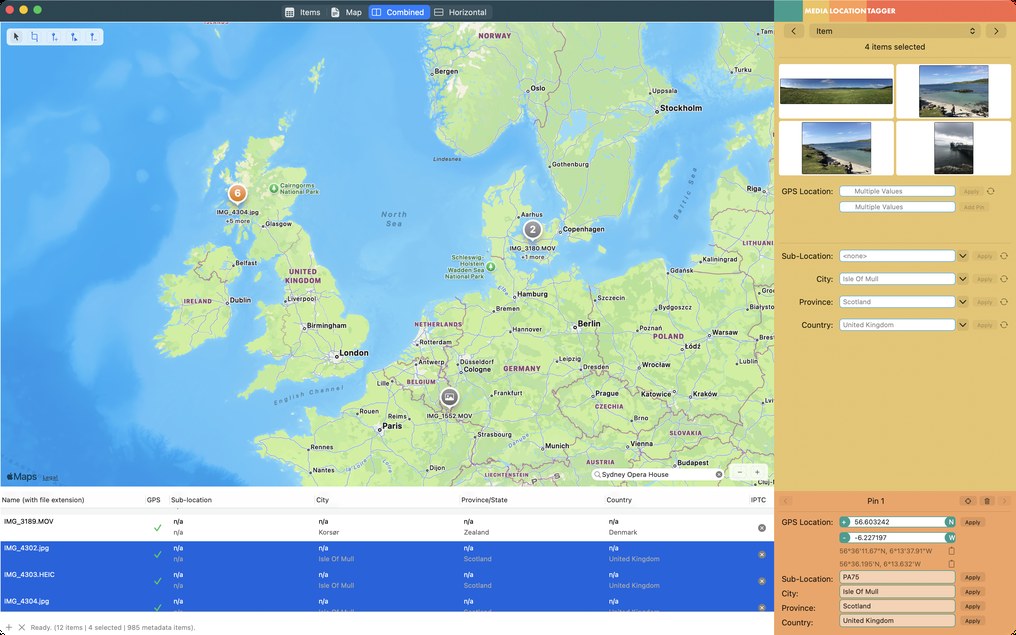
This is the most common situation for DSLR and mirrorless owners. The camera takes great pictures — but every file lands in your library with no GPS information at all, and nothing in Photos or Lightroom will sort by location.
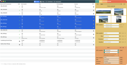
Drag a folder of photos into Media Location Tagger. They show up in the preview table, with a clear visual indicator (a grey "no data" icon in the GPS column) that confirms what you already suspected: nothing's there.
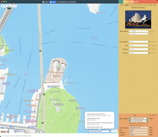
Switch to the map. Type the location into the search bar — "Sydney Opera House", "Yosemite Valley", "my street address". The macOS MapKit framework gives you the same autocomplete you get in Apple Maps.
Drop a pin. Select the files this pin applies to. Click Apply. Done.
Step by step: How to geotag photos on a Mac, and the one-phone-shot-per-stop workflow for cameras without GPS.
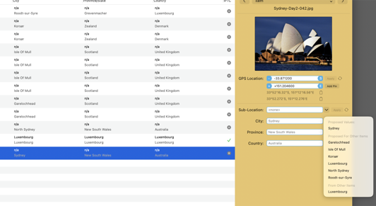
Most photo software accepts whatever the geocoding database decides about a place. Media Location Tagger doesn't. You decide what goes in the city, province, country and sub-location fields. Every time.
Take a picture at the Sydney Opera House. The map suggests Sydney Opera House as the sub-location, Sydney as the city, NSW as the province, and Australia as the country.
Media Location Tagger lets you do all of this:
Stock photo agency wants "New South Wales, Australia" spelled out? Type it once, apply to 800 files. A local newspaper wants the neighbourhood, not just the city? Put it in the sub-location. Internal archive uses a custom convention? It's your call — not the database's.
Step by step: How to add city, state and country names to photos on a Mac.
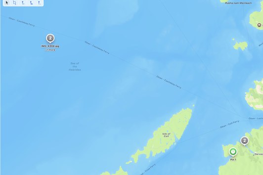
Maybe you set a manual location in the camera before a previous trip and forgot to change it. Maybe the camera's GPS module had a bad fix. Either way, you've got a batch of pictures showing up in the wrong place — sometimes in the middle of the ocean.
The map view shows you the problem at a glance. Pictures from your trip to Paris clustered around the Indian Ocean? You'll see it immediately.
Drag a selection rectangle around the wrongly-placed files. Drop a new pin where they actually belong. Apply.
The old GPS coordinates are overwritten. The IPTC city, province and country fields are updated to match. Both the legacy metadata and the modern XMP packet are kept in sync, so when these files round-trip through Lightroom or Photos later, you won't get the silent disagreement that confuses other software.
Step by step: How to fix the wrong location on photos, in bulk, on a Mac.
If you've ever exported iPhone photos to a stock photo agency, a web gallery, a file browser, or an archive system — only to find them showing up with blank location fields — this is why.
Drag your iPhone photos in. The GPS column shows green (complete). The IPTC column shows a warning triangle (incomplete) or grey (empty).
Media Location Tagger fills in the missing IPTC fields from the GPS coordinates, using a built-in offline database. Fast, batch, no internet connection required, no rate limits.
You still choose what goes in. If the suggested city name isn't what you want — "Cupertino" instead of "Apple Park", say — override it. The tool suggests; you decide.
Same workflow handles mixed batches: some shots from your iPhone (with GPS), others from your pro camera (without). Apply the same location tags across all of them in one go.
Step by step: Why iPhone photos have coordinates but no place names, and how to fill them in.
No library to maintain. No rendering controls. No subscription. Just the metadata, the map, and the files you care about.
HEIC, JPEG, RAW (CR2, NEF, ARW, RAF, ORF, DNG and others), TIFF, MOV, MP4 and more.
Reads and writes EXIF, QuickTime, IPTC and XMP — and keeps them in sync, so other software doesn't get confused.
Decimal degrees, DMS, DMM, signed or with N/S/E/W references. Paste from anywhere; the tool figures it out.
Drop pins, switch between them, drag-rectangle to select files in a region, cluster large file sets automatically.
Autocomplete via the macOS MapKit framework. If Apple Maps knows it, so does Media Location Tagger.
Review current and suggested values in the table and sidebar — your files aren't modified until you click Apply. Honest, detailed error reporting if a write fails.
City, province and country lookups from a packaged database. No internet required for bulk operations.
Apply one location, or one set of IPTC fields, to hundreds of files at once. The reason this tool exists.
Select any number of files and see the combined values of their metadata at a glance — including a thumbnail preview so you know what you're tagging.
Real AppKit. Native Apple Silicon. Signed and notarized. Drag-and-drop, Services menu — everything a Mac user expects.
General photo software — Lightroom, Apple Photos, Photo Mechanic — has location features bolted on. They were designed for adjusting exposure, organising libraries, rating images. Location editing is usually hidden in a submenu, limited to one coordinate format, awkward to apply in batch, with no way to control IPTC fields separately from GPS.
When customers of A Better Finder Attributes kept asking for better geo-location features, the same question came up over and over: "I thought this would be in here somewhere — where do I find it?"
The answer, honestly, was nowhere. The right place for it isn't inside a general file utility, or a general photo manager. It's in a tool designed from the ground up around this one job: pick files, pick locations, apply.
Media Location Tagger has no library to maintain. No rendering controls. No rating sliders. The entire interface is built around the location-tagging workflow. Drag your files in. Pick the location on the map. Apply. Done.
Add as many files as you like. Use every feature. The trial saves changes to 5 files per session — enough to convince yourself it works on your photos.
Single user license $29.95. Family, Small Business, Business and Enterprise licenses, as well as Forever Upgrades, available in our web store.
Requires macOS 15 Sequoia or later; macOS 27 Golden Gate compatible. Native on Apple Silicon and Intel.